The Perth & District Historical Society Presents:


Views of Perth c.1900
The Photos of Isabel Hardie

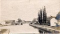
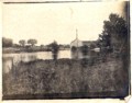
The photos in this section were taken by Isabel Hardie of Perth in the years around 1900. Isabel, and her father, John Semple Hart, who was the owner of the well-known book store on Gore Street, were keen photographers, taking many pictures of Perth and the surrounding countryside. Isabel married William Hardie, Principal of the Perth Collegiate Institute - later moving with him to Ottawa, where she played an active role in the art community, until her death in the 1940s.

Copyright Notice: These photos are the property of John and Hilary Fowler of Perth, who have kindly agreed to make them available on this website. To copy these photos, please contact John Fowler, grandnephew of Mrs. Hardie, at 613 267 7558.

(A. Hearty of Perth transferred the photos from negative to digital format).


Click on any photo to see a larger version


View of Beckwith Bridge from north side of canal at Drummond Street; Cockburn Island to left; foundry chimneys far distant; bridge keeper house close left. View from Drummond Street Bridge east toward Beckwith Street Bridge, centre; far distantare the former foundry chimneys. View from Cockburn Island side of Tay Basin towards north shore, with St. James Church in distance; Summit House at centre left; large buildings on south shore now gone. View North down Drummond Street to Tay Canal and Cockburn Island; Town Hall far left; 'forwarding sheds' at at left across canal.(presumed) View north down Drummond Street across Tay Canal, slightly to the west of previous photo; Cockburn Island ahead; Town Hall far left; presumed 'forwarding shed' across canal at left; sheds close left are now gone. View from Beckwith Street Bridge west to Drummond Bridge; Town Hall distant centre; south bank of the Tay Canal at right, with Tow Path, and present location of Canadian Legion. View of Tay Basin, from Gore Street Bridge, and Drummond Dtreet Bridge; Code Mill and Code Park, on the Little Tay River, ca 1900; T.A. Code home centre distant; town hall roof at far left. Code Park Looking Toward Bolt Factory from Wilson Street, ca 1900 View South From steeple of St. James Church; Drummond Street to the left; summit house front centre; Tay Canal runs across middle of photo. View West From the steeple of St. James Church, on Drummond Street, Perth. View of Haggart Mill, dam, and home from the current location of Harvey Street (now filled in with houses); Town Hall tower at far right distant; Code Mill is centre distant, behind present day Stewart Park. View across Tay Canal from Rogers Road Bridge to Hagagrt Mill centre, and house to the left; Little Tay Bridge at left. The Tay Canal on the east side of Perth, looking to Beckwith Bridge at centre; tow path on right; St. James Church far left; Town Hall far centre; small white Bridge Keeper's house centre right. Steamer is possibly the Aileen, waiting for bridge to swing. This location is not confirmed, but is believe to be the from the Links O'Tay Golf Course (former Matheson Farm) to Perth, with Allans Sawmill in centre; bridge at right would be in right location, but the church steeple at far right is perhaps the wrong location (could be St. Johns?); the river bending from the left is a question. correct.  Therefore unknown. This location appears to be the present location of Last Duel Park, beside the Old Burying Ground; Tay River and Canal ar right.


Photo Gallery Page     The Perth & District Historical Society Home Page

© The Perth & District Historical Society